Chile is 4,300 kilometres long and, in places, barely 180 kilometres wide, a country that exists almost entirely as a coastline. At its northern end sits the Atacama, the driest non-polar desert on earth, where some weather stations have never recorded rainfall. At its southern end, Patagonia breaks apart into fjords, ice fields, and the kind of wind that leans into you like a wall. Between them is a country worth understanding before you book a single flight.
The Atacama: What You Are Actually Going To See
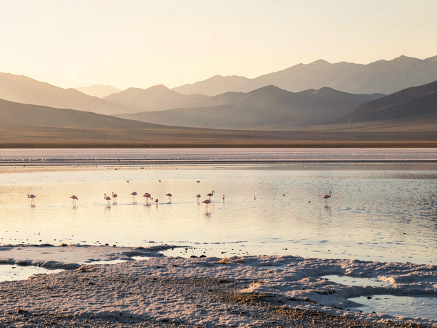
San Pedro de Atacama is the base, a small town at 2,400 metres above sea level in the Antofagasta region. The altitude is real, give yourself a day before you do anything strenuous. The sights that pull people here are the Valle de la Luna, a landscape of salt and clay eroded into shapes that look borrowed from another planet; the El Tatio geysers, which are best at dawn when the cold air makes the steam visible and the crowds have not yet arrived; and the Salar de Atacama, a salt flat that holds a third of the world's lithium reserves and, at its edges, flamingos standing in brine-pink water.
The season matters here. The Atacama's wet season, locally called the Altiplano Winter, runs from December through March. Afternoon thunderstorms are short but can close roads to the geysers. The clearest skies for stargazing, and the Atacama is one of the best places on earth for it, are April through November. Night temperatures drop sharply year-round; pack for it.
Flying into San Pedro means flying into Calama (CJC), the nearest commercial airport, then taking a shared transfer of roughly 100 kilometres. The transfer takes about an hour and a half and costs between 10,000 and 15,000 Chilean pesos per person on a shared shuttle. LATAM and Sky Airline both connect Calama to Santiago (SCL).
![Andean Salt Flat Sunrise]()
Andean Salt Flat Sunrise
Image credit : AI
I'm exploring the vast salt flats of the Andes, a breathtaking start to my Chile travel itinerary.
The Internal Flights: Where the Trip Is Actually Decided
There is no practical overland route between the Atacama and Patagonia in a standard two-week trip. The distance from Calama to Punta Arenas, the gateway to Chilean Patagonia, is over 4,000 kilometres. Driving it is a weeks-long undertaking. The flight from Santiago to Punta Arenas (PUQ) takes roughly three and a half hours. This is the connection that decides the shape of the trip.
Book the Santiago to Punta Arenas leg as early as the rest of the itinerary allows. Seats on this route fill fast in the southern hemisphere's summer season, which runs from November through March, the peak window for Torres del Paine. Fares on LATAM or Sky Airline booked three to four months out typically run between 60,000 and 120,000 Chilean pesos one way, depending on how close to the summer peak you are travelling. Fares booked within a month of travel in January or February can be two to three times that. The same logic applies to the Calama leg: book both internal flights at the same time you book your international arrival.
One routing detail that catches people: if your international flight arrives in Santiago and you have a same-day connection to Calama or Punta Arenas, build in at least four hours. Santiago's Arturo Merino Benítez International Airport handles international and domestic flights in the same terminal complex, but immigration and baggage reclaim during peak season can consume two hours on their own.
Patagonia: Torres del Paine and What Surrounds It
Punta Arenas is the regional capital of Magallanes, a city of around 130,000 people on the Strait of Magellan. Most travellers move on quickly to Puerto Natales, three hours north by bus, which is the actual jumping-off point for Torres del Paine National Park. The bus between Punta Arenas and Puerto Natales costs around 10,000 to 15,000 pesos and runs several times a day.
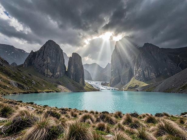
Torres del Paine is the reason most people come this far south. The park is built around a massif of granite towers, the Torres themselves, rising above a landscape of turquoise lakes, glaciers, and pampas where guanacos graze in herds. The classic trekking circuit is the W Trek, a four-to-five-day route that covers the three main arms of the park: the Torres viewpoint, the Valle del Francés, and the Grey Glacier. Refugio accommodation along the W sells out months in advance for the November-to-February window. Book the refugios and the park entrance simultaneously, CONAF, the Chilean national forestry agency, requires advance reservation for entry during peak season.
The wind in Patagonia is not a weather event. It is a permanent condition. Gusts in the park regularly exceed 100 kilometres per hour in spring. Lightweight gear that works in the Atacama will fail here. Bring a hardshell, not a softshell, and expect to use it.
![Patagonian Granite Peaks Emerge]()
Patagonian Granite Peaks Emerge
Image credit : AI
I witness the raw beauty of Patagonia's granite towers, a breathtaking scene on my Chile travel itinerary.
The Routing Logic: How to Structure the Two Weeks
The most coherent structure for a two-week Chile trip runs north to south: fly into Santiago, connect immediately to Calama, spend four to five days in the Atacama, fly back to Santiago, then fly south to Punta Arenas and spend five to six days in Patagonia before flying home from Punta Arenas or back through Santiago. This avoids retracing the same ground and lets the landscape change in one direction.
An alternative is to reverse it, start in Patagonia while the refugio bookings are fresh and the weather window is most predictable, then move north to the Atacama for the final days. The Atacama is more forgiving of flexible timing; the Patagonia logistics are tighter. Either direction works. What does not work is trying to add the Lake District, Chiloé, and Easter Island to the same two weeks. Chile rewards focus. Pick the north-south spine and do it properly.
The through-line connecting these two ends of the country is not just distance, it is the way Chile uses altitude, aridity, and cold to produce landscapes that have nothing to do with each other and everything to do with the same long, thin piece of continent. The internal flights are not a logistical inconvenience. They are the seam that holds the trip together.